How can communities choose flood-vulnerability measures that support better planning? This video introduces the research behind a systematic review of assessment methods across community, regional, and infrastructure scales.
Key findings from the paper
The review synthesizes 144 studies published from 2000 through 2025 and consolidates 217 unique indicators.
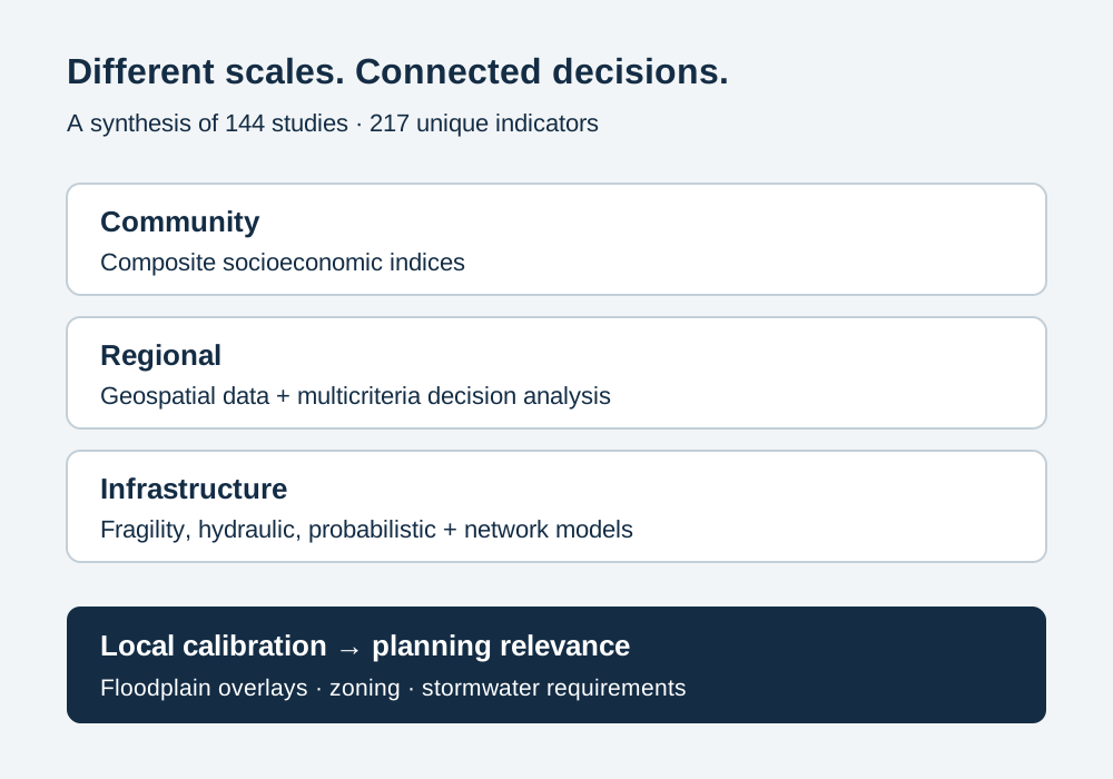
Assessment methods differ by scale: socioeconomic indices, geospatial multicriteria approaches, and infrastructure-performance models capture different aspects of vulnerability.
Useful planning decisions require local calibration, clearer definitions, and validation against observed flood impacts.
Flood-vulnerability assessments often use incompatible definitions and methods. How can evidence across communities, regions, and infrastructure help planners select measures that reflect local conditions and support resilience?
What we did
We reviewed quantitative assessment methods published from 2000 through 2025 using a PRISMA 2020 process. Scopus searches, updated in May 2026, yielded 371 screened records and 144 included studies. A standardized coding framework compared assessment scales, methods, constructs, data sources, weighting, validation, uncertainty, and planning relevance.
What we found
The synthesis identified 217 unique harmonized indicators, represented by 226 indicator–component assignments across exposure, sensitivity, adaptive capacity, and coping capacity.
Community studies mainly used socioeconomic indices; regional studies combined geospatial data and multicriteria analysis; infrastructure studies used fragility, hydraulic, probabilistic, and network-performance models.
Inconsistent definitions, limited independent validation, weak treatment of indicator interactions, and low transferability constrained comparison. Land-use variables emerged as actionable factors across scales.
Why it matters
The inventory can help municipalities audit existing assessments and select indicators supported by local GIS, census, and cadastral data. These measures can inform floodplain overlays, zoning, and stormwater requirements after local calibration. The review is limited to one database and English-language publications; methodological differences precluded meta-analysis, so its framework supports context-sensitive selection rather than a universal vulnerability score.
Different scales require different assessment tools. The review connects them through a shared indicator inventory and the need for local calibration.
Website synthesis based on Mohammadi et al. (2026); not a reproduced paper figure.
Quantifying Community and Infrastructure Vulnerability to Floods: Implications for Land-Use Planning and Resilience
Published · 2026 · Journal article
Mohammadi, M., Tafazzoli, M., Naeijian, F., & Rahbar, S. (2026). Quantifying Community and Infrastructure Vulnerability to Floods: Implications for Land-Use Planning and Resilience. Sustainability, 18(20), 10375. https://doi.org/10.3390/su182010375
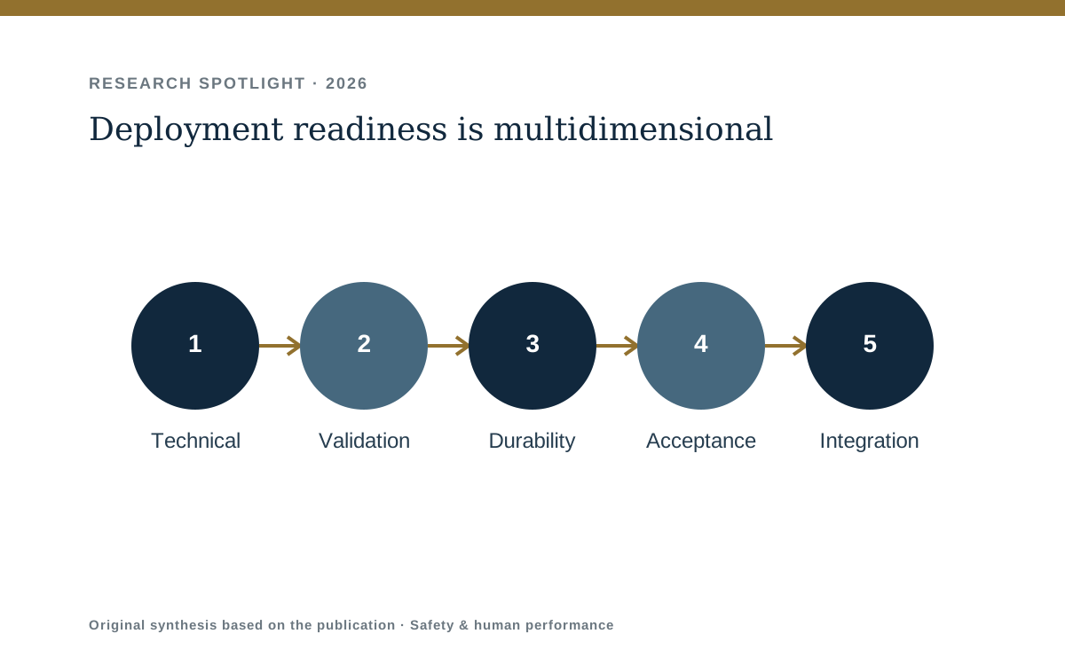
The multidimensional readiness framework helps researchers and safety teams evaluate whether a garment can survive real work, fit workflows, protect worker interests, and produce information that can support decisions.